13 Apr 2023, 16:02 UTCviews —
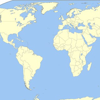
World Earthquakes on the Map pinned a photo
Channel
@MapQuake
On this record: Growth · Engagement · Posts · Cite this entry
669subscribers
+0 since we began measuring on 6 August 2026
Risers and fallers across the register · movement among entries of Under 1,000.
| Telegram ID | -1001130528098 |
|---|---|
| Type | Channel |
| Username | @MapQuake |
| Created | Between 1 June 2017 and 31 October 2020— estimated from Telegram’s id allocation, not measured. How this range is calculated. |
| First recorded | 6 August 2026 |
| Last confirmed live | 22 August 2026 |
| Measurements held | 4 |
| Confirmed unchanged | 1 time, most recently 22 August 2026 |
| On Telegram | t.me/MapQuake |
| Measured (UTC) | Subscribers | Change |
|---|---|---|
| 22 Aug 2026, 23:19 | 669 | -2 |
| 14 Aug 2026, 12:28 | 671 | +2 |
| 6 Aug 2026, 17:18 | 669 | no change |
| 6 Aug 2026, 17:01 | 669 | first reading |
20 posts held, back to 12 April 2023 — the reader has not yet reached the start of this channel’s public history, so older posts may sit further back, unread. Read across 1 pageof Telegram’s post history, 20 posts per page.
Nothing published in the last 30 days. ERR and ER are rolling 30-day measures, so there is nothing to compute — we hold 20 posts for this entry, the most recent from 13 April 2023. An engagement rate over an empty window would be a number about nothing.
World Earthquakes on the Map pinned a photo
M6.2 - 211 km SW of Port McNeill, Canada Mag: 6.2 Depth: 11km Date-Time: 2023-04-13 15:54:56 UTC @MapQuake
M4.3 - Fiji region Mag: 4.3 Depth: 393.7km Date-Time: 2023-04-13 11:57:44 UTC @MapQuake
M4.5 - 144 km ESE of Iquique, Chile Mag: 4.5 Depth: 105.816km Date-Time: 2023-04-13 08:18:10 UTC @MapQuake
M4.3 - south of the Fiji Islands Mag: 4.3 Depth: 520.776km Date-Time: 2023-04-13 07:09:04 UTC @MapQuake
M5.4 - Owen Fracture Zone region Mag: 5.4 Depth: 10km Date-Time: 2023-04-13 03:24:09 UTC @MapQuake
M4.3 - Mag: 4.3 Depth: 8km Date-Time: 2023-04-13 03:00:01 UTC @MapQuake
M4.6 - 96 km NE of Angoram, Papua New Guinea Mag: 4.6 Depth: 10km Date-Time: 2023-04-13 02:17:51 UTC @MapQuake
M4.4 - 17 km NNW of Rabaul, Papua New Guinea Mag: 4.4 Depth: 166.263km Date-Time: 2023-04-13 02:07:58 UTC @MapQuake
M4.9 - 132 km ENE of Angoram, Papua New Guinea Mag: 4.9 Depth: 10km Date-Time: 2023-04-13 01:50:27 UTC @MapQuake
M4.4 - 128 km SE of Ishinomaki, Japan Mag: 4.4 Depth: 31.232km Date-Time: 2023-04-13 00:55:11 UTC @MapQuake
M4.9 - Pulau Pulau Tanimbar, Indonesia Mag: 4.9 Depth: 70.203km Date-Time: 2023-04-12 23:07:46 UTC @MapQuake
Showing the 12 most recent of 20 posts we hold for @MapQuake. View and reaction counts are the latest single reading for each post, not a live figure, and a recent post is still accumulating both. A view count marked ≈ was rounded by Telegram before we ever saw it — t.me prints views in full below 1,000 and to three significant figures above, so ≈1,200,000 means somewhere between 1,150,000 and 1,249,999. Unmarked counts are exact. Text is reproduced from the public post preview and truncated for length.
A live page changes as we take new readings, so a citation should name the measurement it is based on, not just the URL. The line below cites the subscriber count as measured 22 August 2026 — this entry's latest reading, not the date you are reading this.
“World Earthquakes on the Map” (@MapQuake), 669 subscribers as measured 22 August 2026. Telegram Register, tgregister.com/channel/MapQuake.
Full measurement history, CC BY 4.0. Every reading this register holds for this entry, not just the latest one, as a dated, downloadable record: CSV · JSON. Free to use with attribution to tgregister.com. Each file carries its own generation timestamp, which is the figure to cite for exactly when the data was retrieved.